
Regional Haze Situation
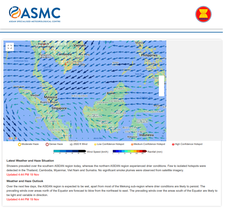
This page provides an overview of the hotspot and wind information in the ASEAN Region.
Daily Haze Map in The ASEAN Region
The hotspots depicted in the map are derived from the NOAA satellite and they represent locations with possible active fires. Hotspots may go undetected due to cloudy conditions or incomplete satellite pass. The 2500 ft winds (depicted by arrows) are model analysis winds.
Metadata
Metadata for Daily Haze Map in the ASEAN region
Geometry Coordinates | [ [ [ 91.5, -7.3 ], [ 91.5, 30 ], [ 127.5, 30 ], [ 127.5, -7.3 ], [ 91.5, -7.3 ] ] ] |
Data access API | https://api.wis2.asmc.asean.org/collections/regional_haze/items/REGIONAL_HAZE_MAP |
WIS 2 Topic Hierarchy | origin/a/wis2/sg-mss-asmc/data/recommended/weather/prediction/forecast/short-range/deterministic/limited-area |
Update Frequency | Once daily. 08:30 UTC to 10:30 UTC |