
Satellite Images JPSS 1 NOAA 20
This page provides high-resolution satellite data captured by the JPSS-1/NOAA-20 satellite.
NOAA-20/JPSS-1 VIIRS True Colour Image
This data contains the NOAA-20/JPSS-1 VIIRS True Colour RGB Image (375 m resolution). The image is overlaid with fire hotspot data.
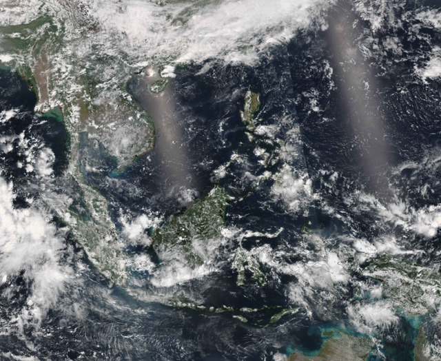
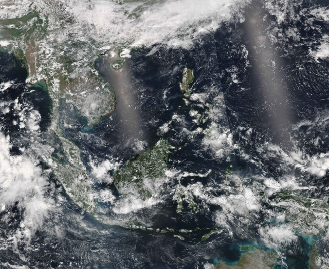
Metadata
Table for NOAA-20/JPSS-1 VIIRS True Colour Image Standard Version and Near Real-Time Version Metadata
Standard Version | Near Real-Time Version | |
Geometry Coordinates | [ [ [ 80, -15 ], [ 80, 30 ], [ 140, 30 ], [ 140, -15 ], [ 80, -15 ] ] | [ [ [ 80, -15 ], [ 80, 30 ], [ 140, 30 ], [ 140, -15 ], [ 80, -15 ] ] |
Data access API | ||
WIS 2 Topic Hierarchy | origin/a/wis2/sg-mss-asmc/data/recommended/weather/space-based-observations/noaa-20/viirs | origin/a/wis2/sg-mss-asmc/data/recommended/weather/space-based-observations/noaa-20/viirs |
Update Frequency | Once daily. 14 UTC to 18 UTC | Once daily. 08 UTC to 12 UTC |
NOAA-20/JPSS-1 VIIRS Smoke Haze RGB
This data contains the NOAA-20/JPSS-1 VIIRS Smoke Haze RGB Image (375 m resolution). The image is overlaid with fire hotspot data.
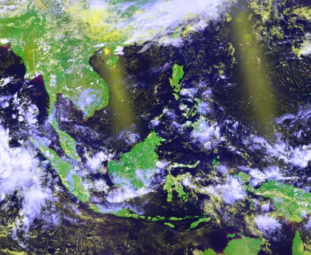
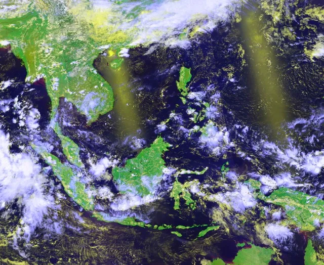
Metadata
Table for NOAA-20/JPSS-1 VIIRS Smoke Haze RGB Standard Version and Image Near Real-Time Version Metadata
Standard Version | Near Real-Time Version | |
Geometry Coordinates | [ [ [ 80, -15 ], [ 80, 30 ], [ 140, 30 ], [ 140, -15 ], [ 80, -15 ] ] ] | [ [ [ 80, -15 ], [ 80, 30 ], [ 140, 30 ], [ 140, -15 ], [ 80, -15 ] ] ] |
Data access API | ||
WIS 2 Topic Hierarchy | origin/a/wis2/sg-mss-asmc/data/recommended/weather/space-based-observations/noaa-20/viirs | origin/a/wis2/sg-mss-asmc/data/recommended/weather/space-based-observations/noaa-20/viirs |
Update Frequency | Once daily. 14 UTC to 18 UTC | Once daily. 08 UTC to 12 UTC |
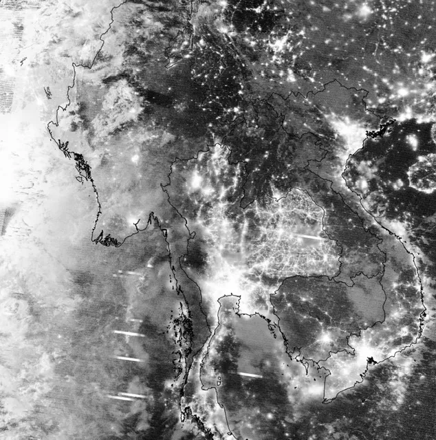
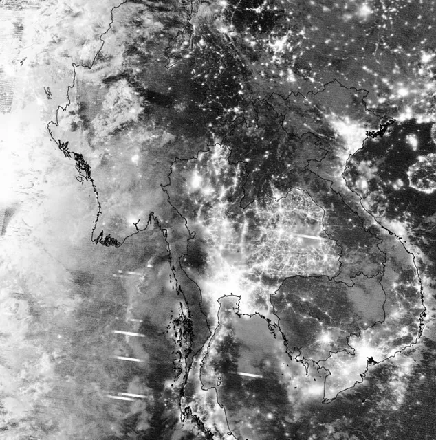
NOAA-20/JPSS-1 VIIRS Dynamic Day Night Band
This data contains the NOAA-20/JPSS-1 VIIRS Dynamic Day Night Band Image (750 m resolution). The image is overlaid with fire hotspot data.
Metadata
Table for NOAA-20/JPSS-1 VIIRS Dynamic Day Night Band Standard Version and Near Real-Time Version Metadata
Standard Version | Near Real-Time Version | |
Geometry Coordinates | [ [ [ 80, -15 ], [ 80, 30 ], [ 140, 30 ], [ 140, -15 ], [ 80, -15 ] ] ] | [ [ [ 80, -15 ], [ 80, 30 ], [ 140, 30 ], [ 140, -15 ], [ 80, -15 ] ] ] |
Data access API | ||
WIS 2 Topic Hierarchy | origin/a/wis2/sg-mss-asmc/data/recommended/weather/space-based-observations/noaa-20/viirs | origin/a/wis2/sg-mss-asmc/data/recommended/weather/space-based-observations/noaa-20/viirs |
Update Frequency | Once daily. 02 UTC to 06 UTC | Once daily. 20 UTC to 00 UTC |